
Beyond the MAP: open audience questions
Answers from the keynote speaker and the panel | Sint-Niklaas, 10 September 2026
During Beyond the MAP a number of audience questions came in through the Q&A tool that we did not get to on stage. As promised, the keynote speaker and the panel members answer them below.
Question 1
How can we improve data quality? Can AI also help with that?
Answer by Aloïs Brunel, IQGeo
Yes. AI can improve data quality in two complementary ways.
First, visual AI helps digitize the current state of the infrastructure and document what work was actually done, including how it was done. It can analyse field photos, drone surveys or satellite imagery to identify assets, capture their condition and extract evidence of completed work. This creates better documentation and reduces the gap between field reality and the system of record.
Second, agentic AI can continuously audit the data already in those systems. It can find duplicate assets, missing attributes, broken topology or conflicts between GIS, inventory and work-management systems. It can investigate each case, present the evidence and recommend a correction.
With confidence scores, traceability and human approval where needed, the two approaches create a continuous loop: visual AI captures field truth, and agentic AI keeps the digital record consistent with it.
Question 2
Claude deleted its first complete company database as the quickest way to solve a problem. What are your thoughts about the risks of individual usage at scale?
Answer by Sebastiaan Bosmans, WKF Engineering
Whether or not that particular story happened exactly as told, the scenario is realistic. The risk is rarely the model itself; it is the access we give it. An AI agent with write access to a production database will sooner or later pick a shortcut that a person would never take.
Individual use at scale multiplies that risk: many colleagues connecting their own tools to company data, each with their own settings, and nobody with the full overview. That is why we give agents only the rights they need, let them work on copies or in a test environment rather than on live systems, require human approval for anything destructive or irreversible, and make sure backups and logging are in place.
Just as important is a clear company policy on which tools may access which data, and training so people understand what they are delegating. AI can save a lot of time, but the responsibility stays with people.
Question 3
Are there interesting projects, solutions or impressive systems you have seen for “NLGIS”? Things that would not be possible with classic GIS?
Answer by Nico Van de Weghe, Ghent University
Examples worth looking at include third-party QGIS tools such as GIS Copilot and Esri’s Data Explorer (beta), which lets people explore map data through everyday language. Most examples I have personally seen were demonstrations, so I remain cautious about their maturity. The main gain is making GIS easier to access and combining operations into workflows. I would not yet claim fundamentally new spatial analyses that conventional GIS cannot perform.
Question 4
A lot of companies want to use AI to improve efficiency. But where do you best start? And could you use AI to help you discover and prioritise?
Answer by Maarten Verschuere, keynote speaker
Start with defining a Quick Win for your organisation. This is a project that is easy (cheap) to do and delivers value in the short term.
On page 71 in the book “AI Will Replace You”, of which you received a copy at the event, there is an explanation on how to identify your first use case. There are 5 steps, from defining your DNA to selecting your winners and the next steps. You can have a structured conversation with ChatGPT, Copilot or Claude (or the AI you like) and prompt the AI engine to guide you through these steps or join the brainstorm.
Question 5
Are we looking for AI to help challenge our processes and bring “perfection”? How can we evaluate the quality of outputs when inputs are the source of trust?
Answer by Nico Van de Weghe, Ghent University
AI can help challenge assumptions and flag inconsistent inputs, but I would define quality in relation to the decision rather than “perfection”. Good data do not guarantee that the question was understood or the analysis is valid. From a GIS perspective, I would check results against independent observations, established methods and explicit spatial rules, paying attention to connectivity, scale and time. Uncertainty should remain visible, and people remain accountable for the result.
Meet Nico Van de Weghe: AI-Community@UGent
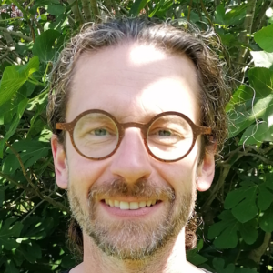
I am one of the senior experts helping to build AI-Community@UGent, a community for exchanging knowledge and experience around AI. It welcomes people from both within and outside UGent. If you would like to stay up to date with GenAI techniques and receive almost daily practical examples and best practices, please email me to join. Feel free to spread the word to others who might be interested.
Personal reflection by Nico Van de Weghe
Beyond the map: towards collaboration with intelligent geospatial systems
Nico Van de Weghe | Ghent University
Contact: Nico.VandeWeghe@UGent.be
Read the full reflection
“It rained heavily in my neighbourhood last week. If it rains that heavily again next week, where could flooding occur?” This is the kind of question I want my mother-in-law to be able to ask a future geographic information system. It also captures much of what I wanted to bring to the Beyond the MAP panel in Sint-Niklaas on 10 September. She should be able to explain her problem without knowing which datasets, hydrological models or GIS operations are required. Yet answering it would demand considerable geographic knowledge: what counts as her neighbourhood, which rainfall event is being considered, how terrain and drainage affect the outcome, and how uncertain the prediction is. Making GIS easy to use does not make GIScience easy.
The appeal of natural-language GIS is that this complexity could become accessible through an ordinary conversation. The user describes the problem, and the system helps work out how to investigate it. The answer might still be a map: language is excellent for asking the question, while a map is often still excellent for understanding the answer. What changes is how we arrive there. Maps have evolved from paper to digital, interactive and dynamic representations, but mapping remains the process of selecting and transforming aspects of reality into something we can use. I see the next development as people and intelligent systems collaborating more closely in that process. Beyond the map does not mean beyond geography.
For that collaboration to work, geographic knowledge needs to shape the intelligence underneath. My background in moving objects and spatial reasoning, together with my experience of knowledge-based, data-driven and generative approaches, makes me particularly interested in how these can complement each other. Explicit knowledge can express constraints, learning methods can reveal patterns, and generative models can help interpret questions and connect tools. This is why I think in two directions: AI for Geo, but also Geo for AI. Geography can contribute to AI itself, because talking convincingly about the world does not automatically mean reasoning correctly about its spatial relationships. Research on world models explores how systems can learn from observations and interactions to predict how physical situations develop. This remains a research challenge, but sensing, topology, movement and change over time are problems our community has studied for decades.
That geographic competence becomes especially important as we move from generation to delegation. I sometimes write “aGENtic AI”, keeping GEN inside the word, because generating content remains useful while the scope of the system expands. With access to tools and procedures, agents can increasingly carry out work. In a network context, an agent could compare a field report with a digital twin, investigate a discrepancy and prepare an update for review. This is a direction to explore, with the degree of autonomy depending on what works reliably and what is at stake. Preparing an exploratory analysis and issuing an operational instruction carry different responsibilities. People consequently need to define goals, check evidence and decide when to intervene; domain expertise becomes central to supervising the work.
Delegation therefore asks us to think about the whole working environment. A GIS is not just software, and an AI system is not just a model. Both involve hardware, data, people and organisational arrangements that determine whether a capability becomes useful in practice. Reusable skills are interesting here because they can translate expertise into procedures: which sources to consult, which checks to perform and how to report a result. When experts identify shortcomings, their feedback can improve subsequent versions. Organisational learning can accumulate in a skill, provided that we deliberately maintain and validate it. This offers a way for knowledge developed through individual interactions to become available to colleagues and future workflows.
Those checks matter because fluent answers and successful tool execution do not by themselves establish that an analysis is valid. Garbage in, garbage out remains relevant, but good inputs alone are no guarantee either: a system can misunderstand the question or apply an unsuitable method to reliable data. Quality therefore needs to be judged in relation to the decision, using independent observations, established methods and explicit spatial constraints, with uncertainty kept visible. For critical infrastructure, I would put it simply: don’t let the model invent the network; let it interrogate the trusted network. Delegating work should make responsibility clearer, including who decides whether the result is suitable for use.
Once we consider the whole system, strategic questions follow. Who controls the interface through which people ask questions, who provides trusted data, and who coordinates the workflow? These roles may be distributed across established GIS providers, specialist GeoAI organisations and general AI platforms. I would not predict a winner, but these dependencies deserve attention when deciding what expertise and infrastructure an organisation should develop. They also make me question the word “transition”. A transition to what? If continuous change becomes the normal condition, organisations need a lasting capacity to adapt. That means broad AI literacy alongside people who actively follow developments, test their relevance and translate them into practice.
For me, this brings the discussion back to the question I would like my mother-in-law to ask. Productive collaboration depends on combining human purposes, experience and judgement with systems that can help find information, explore alternatives and carry out work. My advice is to become very good at your domain, and very good at using AI within that domain. Learning how to bring those competences together also motivates my involvement as one of the senior experts helping build AI Community@UGent. We share developments in GenAI techniques and almost daily practical examples and best practices. People within and outside UGent are welcome to follow or contribute. If you are interested, send me an email and I can give you access.